
Hybrid Surveying Services
Boundary Surveys
Construction Staking
Topographic Surveys

Our boundary surveys are conducted by our experienced surveyors who use state-of-the-art technology to accurately determine the boundaries of your property. We provide detailed reports that can be used for legal purposes and to settle boundary disputes.
Topographic Surveys
Construction Staking
Topographic Surveys
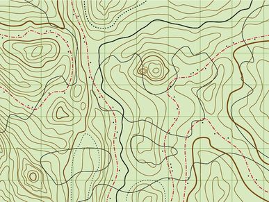
Our topographic surveys provide accurate and detailed information about the contours and features of your property. This information is essential for construction, engineering, and land development projects.
Construction Staking
Construction Staking
ALTA/NSPS Land Title Surveys
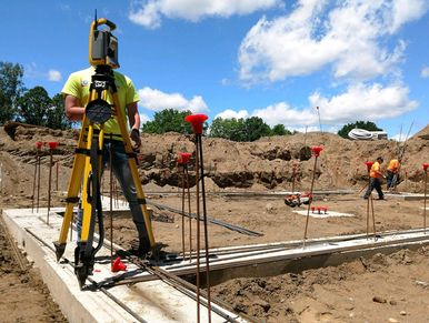
Our construction staking services ensure that your project is built to the correct specifications and within the boundaries of your property. We work closely with contractors and engineers to provide accurate and reliable staking services.
ALTA/NSPS Land Title Surveys
ALTA/NSPS Land Title Surveys
ALTA/NSPS Land Title Surveys

Our ALTA/NSPS land title surveys provide a comprehensive report of your property, including boundary lines, easements, encroachments, and other important information. This is essential for commercial real estate transactions.
FEMA Elevation Certificates
ALTA/NSPS Land Title Surveys
FEMA Elevation Certificates
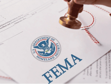
Our FEMA elevation certificates provide important information about the elevation of your property and can be used to determine flood insurance rates. We work with property owners and insurance companies to provide accurate and reliable certificates.
AutoCad Drafting
ALTA/NSPS Land Title Surveys
FEMA Elevation Certificates
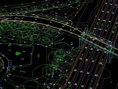
Produce 2D & 3D AutoCAD format layouts for engineering design purposes.
Provide 3D model digital presentations of building designs.
Paper to Cad (digital) conversion.